By Dan Shine
Voice Columnist

New Haven Topography
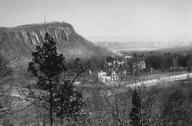
Topography is defined the study of the shape and features of land surfaces.. It is the intent of this article to describe the early topography of Greater New Haven, and to explain its influence on its early inhabitants. New Haven lies at the southern terminus of the central lowland of Connecticut. It is surrounded by ridges to the east and west, hills to the north, and New Haven harbor to the south. The land in between is a flood plain cut by three rivers, the West, the Mill and the Quinnipiac.
The rivers and the harbor provided an easy, convenient mode of transportation for early settlers, and the central plain facilitated settlement, transportation and agricultural development. Thus, the Nine Squares of the early town could expand with ease.
How was this homeland of ours formed and developed, so long before the arrival of human settlers? Much of the following is related to us by Floyd L. Shumway and Richard Hegel of the New Haven Museum and Historical Society: Back in early geological times, during the Triassic period, an enormous north-south depression extending from the shoreline to Massachusetts developed in Connecticut. A large tract of rock dropped below the level of the surrounding area, forming what is known as a trench fault of the earth’s crust. In this way, the twenty-mile wide central valley lowland of Connecticut was created.
Subsequent rain deposited large amounts of sand and other matter into the valley, then volcanic lava forced its way up along the cracks of the original fault and spread across the surface. This lava is known as basalt or locally as “trap rock.” Next, the entire process repeated itself. Subsequent action–the pressing inward of the sides of the valley–forced segments of the trap rock upwards, forming among other things, West Rock and East Rock, and to the north, Sleeping Giant.
The Connecticut River flows due south from the Canadian border to Long Island Sound, on a steady north-south track; and it might seem reasonable that it should continue due south directly into New Haven. However, when that river reaches Middletown, it leaves the central lowland of Connecticut and heads southeast to Old Saybrook.
It is believed that concentrations of resistant basalt lava at Middletown forced the river to change its flow and switch over to its current course. The Quinnipiac Indians would have disagreed: It was their tradition that Hobbomock, the Sleeping Giant changed the course of the river simply by stamping his foot there. Anyway, had the Connecticut River continued south into New Haven, the topography of this area would have been radically different.
To the south lay New Haven Harbor, an estuary that is more than four miles wide. The first white settlers chose this harbor as a place where they could establish an important commercial center, and trade with the West Indies and Europe. However, the harbor was shallow, and the long channel—only seven feet deep at mean low water—was hard to negotiate, even with the ships of the 1600s.
This was the land first inhabited by the Quinnipiac Indians, and later on by a group of Puritans, led by Theophilus Eaton and John Davenport, who hoped that they had found their Promised Land, thereupon to build their “Shining City on a Hill.”
To be continued-